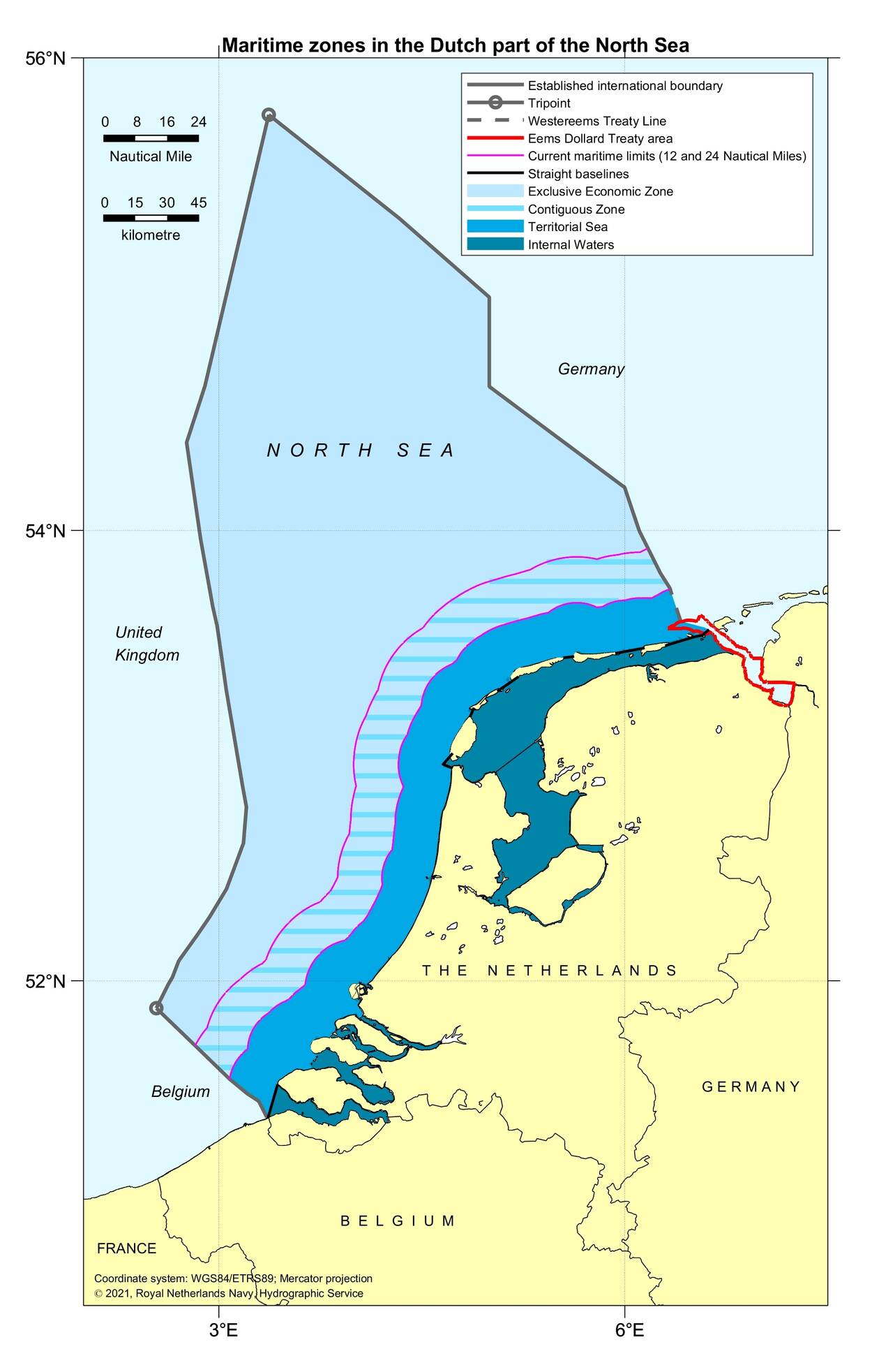
maritime boundaries between Netherlands and Germany world maritime boundaries atlas maritime boundaries between Netherlands and Germany
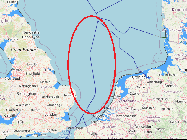
admin Great Britain, Great Britain continental shelf map, Great Britain exclusive economic zone map, Great Britain internal and territorial waters map, Great Britain maritime claims, netherlands, Netherlands boundaries in the North Sea, Netherlands continental shelf map, Netherlands EEZ map, Netherlands exclusive economic zone map, Netherlands internal waters map, Netherlands maritime boundaries, Netherlands maritime claims\, Netherlands straight baseline, Netherlands territorial sea map, Netherlands territorial waters map, UK, UK continental shelf map, UK EEZ map, UK exclusive economic zone map, UK internal waters map, UK maritime boundaries, UK maritime claims, UK territorial waters map 0 Comments maritime boundaries between Great Britain and Netherlands
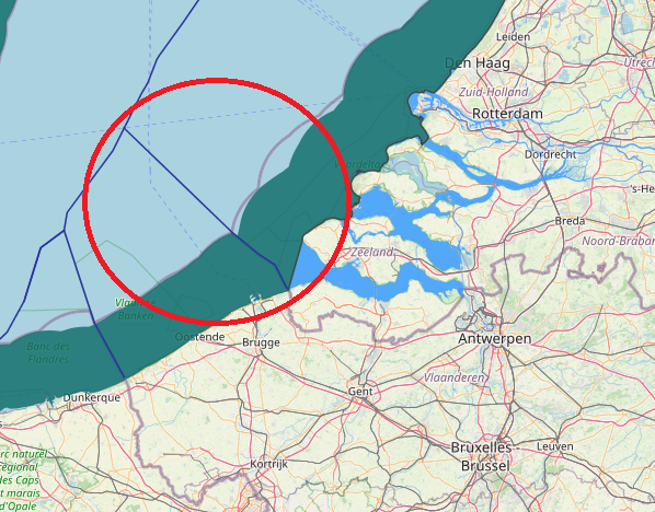
admin Belgium, Belgium continental shelf map, Belgium EEZ map, Belgium exclusive economic zone map, Belgium internal waters map, Belgium maritime boundaries, Belgium Maritime claims, Belgium maritime zone, Belgium territorial waters map, netherlands, Netherlands boundaries in the North Sea, Netherlands continental shelf map, Netherlands EEZ map, Netherlands exclusive economic zone map, Netherlands internal waters map, Netherlands maritime boundaries, Netherlands maritime claims, Netherlands straight baseline, Netherlands territorial sea map, Netherlands territorial waters map 0 Comments maritime boundaries between Belgium and Netherlands
admin Maritime Claims, netherlands, Netherlands boundaries in the North Sea, Netherlands continental shelf map, Netherlands EEZ map, Netherlands internal waters map, Netherlands maritime boundaries, Netherlands maritime claims, Netherlands straight baseline, Netherlands territorial sea map, Netherlands territorial waters map 0 Comments Netherlands maritime claims about outer limits of the territorial sea