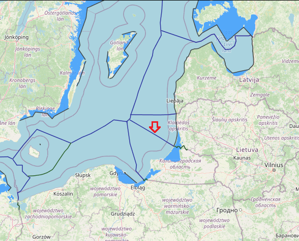
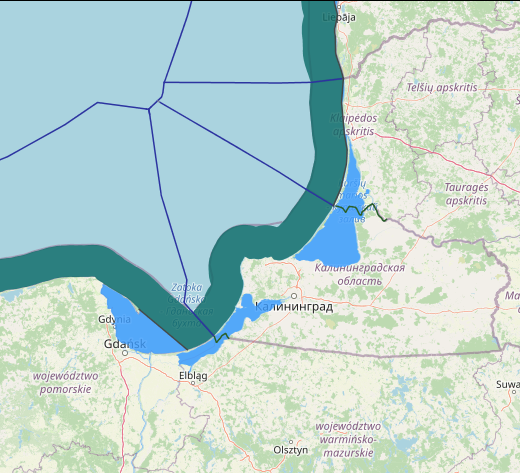
maritime boundaries between Russia(Kaliningrad) and Lithuania
Lithuania-Russia maritime boundary in fact consists of two separate reports: one relating to the delimitation of the exclusive economic zone and the continental shelf, and one relating to the territorial sea. Treaty between the Republic of Lithuania and the Russian Federation on the Delimitation of the Exclusive Economic Zone and the Continental Shelf in the Baltic Sea, 24 October 1997.This treaty has not yet entered into force.
This agreement only related to the exclusiveeconomic zone and the continental shelf, but left the territorial sea untouched. The latter instead formed part of a second agreement concluded on the same date between the parties, delimiting their state border. In order to fill this gap, that part of the treaty on the state border relating to the off-shore maritime areas up to 12 nautical miles (n.m.) will first be addressed.
Lithuania and Russia agreed on the delimitation of their exclusive economic zone and continental shelf, the parties also concluded a treaty concerning their state border. With respect to its form, the same remarks can be made here as those already made with respect to the former treaty, namely that obtaining an authentic text, as well as an English translation of the treaty, took the necessary time and effort.
Because the parties had agreed that these treaties would only be made public at the time of ratification, it took some time, just as with respect to the treaty delimiting the exclusive economic zone and continental shelf, before one could lay a hand on the authentic text of the treaty on the state border. But also producing an English translation of the relevant provisions of the treaty proved particularly burdensome, especially when compared with the other maritime boundary agreements concluded in the Baltic Sea after the dissolution of the former Soviet Union, and immediately related to it. Of the three agreements which chronologically preceded this one, the majority not only provided that besides the national languages of the parties involved, also English is considered to be an authentic language, but also that in case of divergence of interpretation, the English text should prevail.
The treaty itself is rather succinct. Also the accompanying description of the actual course of the state border, which, together with the attached maps and chart, form an integral part of the Treaty, only has a few paragraphs on the
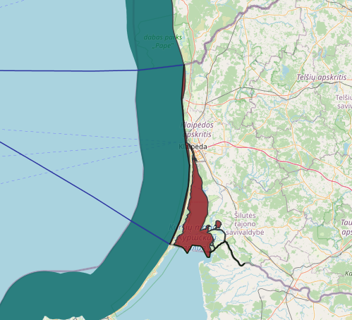
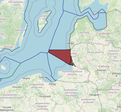
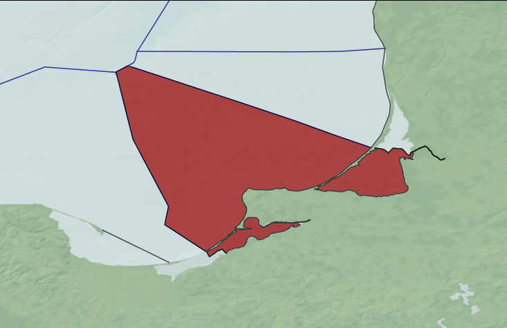
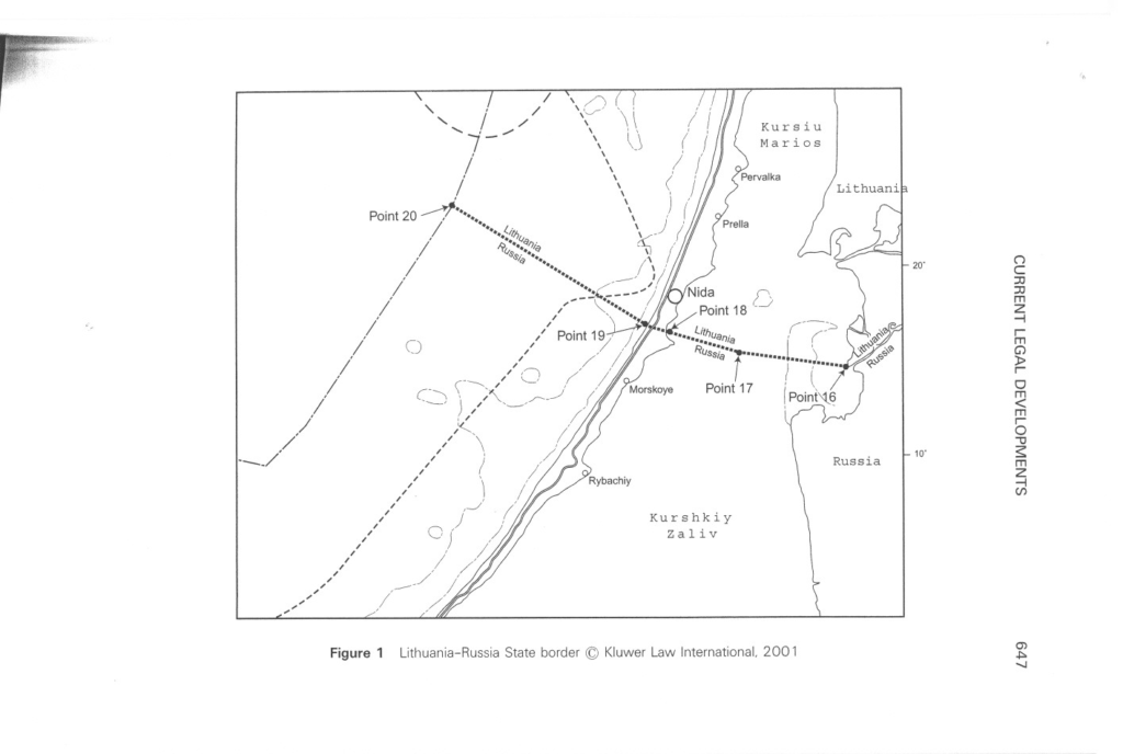
maritime boundary. It delimits the water areas east as well as west of the Kursiu promontory, i.e. the Kursiu Lagoon on the one hand, and part of the southeastern Baltic Sea on the other. The two turning points on the Kursiu promontory rely heavily on a pre-war treaty concluded between Lithuania and Germany, in which the so-called Border East and Border West were determined. Even though the treaty itself does not clearly distinguish between the segments that delimit territorial sea or internal water areas, the fact that point 20 is described as “the point of intersection of the outer limit of the Parties territorial seas” and is moreover located 12 n.m. from the Kursiu promontory, indicates that the last segment between points 19 and 20 constitutes a territorial sea boundary. As a result, the territorial sea is delimited by means of a single straight line. Given the smooth curving nature of the Kursiu promontory, the parties relied on the principle of equidistance in order to arrive at this delimitation.
Another salient feature of this treaty, when compared with other recently concluded agreements in the area, is that the parties do not follow the contemporary practice of states in the Baltic Sea of relying on the World Geodetic System 1984 (WGS 84) when delimiting maritime areas. Only the Russian Federation seems to refuse to follow this general tendency at present. This normally results in the presence of two sets of coordinates in treaties concluded by this country, according to the different data used by the parties on their respective nautical charts. If this method was still followed by the Lithuania. . .Russia EEZ & CS Treaty, the territorial sea delimitation goes one step further, since the Description only relies on the Russian system of coordinates.


Post Comment
You must be logged in to post a comment.